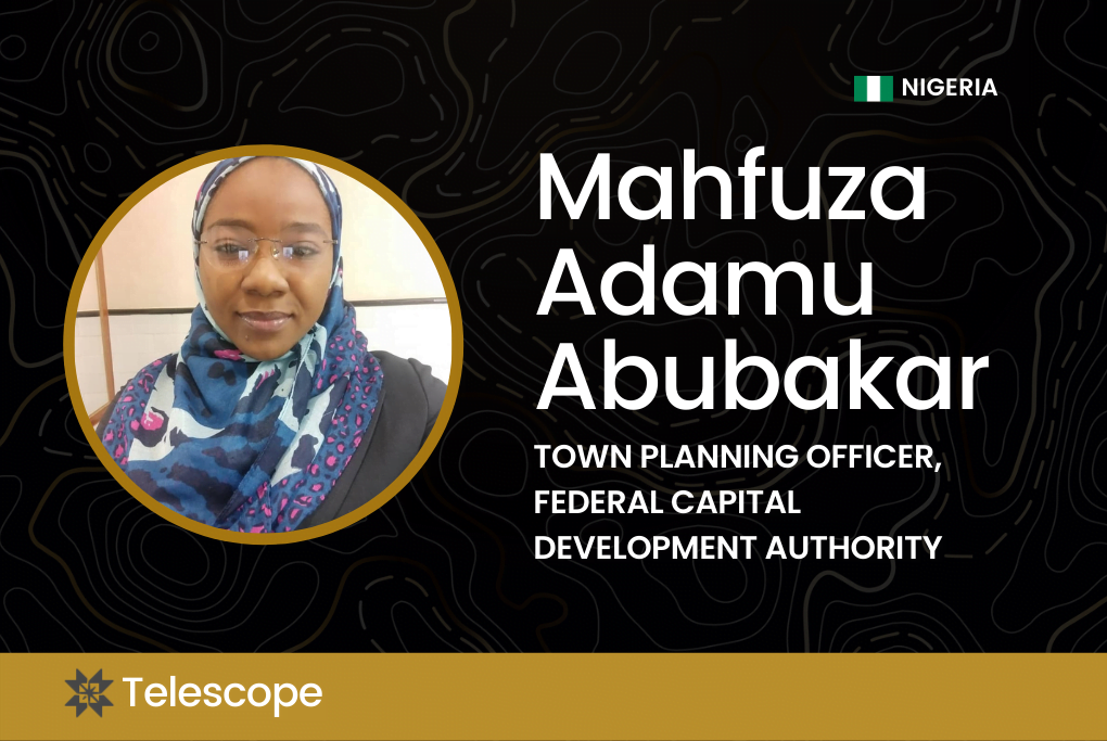
NorthStar Telescope is a profile series for professionals of African descent in geospatial, geography, geoscience, and GIS industries.
What do you do in the GIS industry?
I am a Town Planning Officer for the Federal Capital Development Authority (FCDA) in FCT, Abuja, Nigeria.
I am also a Registered Town Planner with the Town Planners Registration Council of Nigeria (TOPREC) and hold membership with various professional bodies which include, The Nigerian Institute of Town Planners (NITP), Geoinformation Society of Nigeria (GEOSON), African Women in GIS (AWGIS) and the Nigerian Cartographic Association (NCA). During my leisure time, I love to support the ENGINE Programme (Educating Nigerian Girls in New Enterprises). Mercy Corps Nigeria has awarded a certificate of participation to this effect for the first year I volunteered in 2018.
I’ve received many awards including Winner (Team YC46), Abuja International Housing Show Youth Competition on Affordable Housing Designs & Ideas December (2021), 1st Runner Up, Geoinformation Society of Nigeria, GIS Day Innovation Challenge & Competition (November 2021), Outstanding Candidate, IAYG Mapping Horizons GIS Competition (December 2020), 1st Runner Up, African Women in GIS, GIS Day 2020 Map Article Competition (December 2020), Community Vanguard, NorthStar, C3 Initiative and GeoTech Vision, (Education Spotlight on the Application of GIS in digital equity, June 2020).
What inspires you to be in GIS?
I am personally impressed by the advancement of GIS Technology and how it is applied in the management of environmental hazards and emergencies in so many areas across the globe. It is fascinating. Another reason is how effective it is for communication and decision making, especially in the security sector, disaster, and emergency management.
That [blew] my mind because conceiving a crime-free and sustainable environment is a big deal for me, which is why I am currently volunteering as a GIS analyst for the Blessing Life Foundation where we developed a mobile application, YawaSOS. This is an emergency response app that is location-based with about 1 to 3 meter accuracies for the first respondent to pinpoint the exact location of a distress call.
My main research interest is in the application of GIS in the security sector and the risk associated with the improper location of facilities to human life, properties, and the environment as a whole. As a result, I have actively participated in and presented papers at research conferences such as Geoinformation Society of Nigeria, Nigerian Cartographic Association, and Nigerian Institute of Town Planners.
What does it mean to be a Black professional in this industry?
Although I am Nigerian, and not in a predominantly white environment, I will relate this to being a female from the Northside in the industry. What I can say about this is that being a Black or female professional means being alone a lot of the time because the majority of people are under the impression that Black professionals and female professionals in the job need extra specialized training and credentialing in the profession where they are mostly seen as racial minorities.
This also comes with challenges like outright discrimination, which many of us still face. There are also psychological costs to being one of just a few Black or female faces in the industry because one has to carefully manage their emotions in so many ways. But one truth for sure is that I have never really struggled with my confidence as a Black woman whether in Town Planning or in my GIS profession. I am also proud to say that I have been to places and also been part of so many things where women did better than men.
My advice to Black professionals and women GIS enthusiasts is not to feel intimidated or discouraged. Rather, they should focus on their goals and they will get there. There is also a need for them to identify their area of interest, do some research, equip themselves, and acquire relevant skills through training and short-term courses while embracing more practice. That is the key.
Do you have any intersections in your work?
Over time, I have developed skills in spatial analysis, report writing, research, ICT, mobile data collection, and GIS Mapping for Development Projects from experience in working with peers and organizations. At my workplace, we use GIS to build databases for layout designs that have been generated over time in Abuja, the federal capital city of Nigeria. My department has a research unit where environmental issues are identified and studied using GIS tools.
What are some projects that you’ve worked on?
My recent work utilizing the GIS tool includes spatial distribution of Automobile Workshops in Gombe Metropolis, Nigeria, Spatial Analysis of Neighbourhood Security in Karu Urban Area, Abuja, and then it expanded to mapping crime incidents, hotspots, and the pattern of distribution (identifying if patterns are clustered, random or dispersed).
I have also worked on mapping Covid-19 spread across Nigeria over an extended period, analyzing the effect on Nigeria’s socio-economic well-being by producing relevant maps with GIS tools. Learn more about my work where I examine the impact of Covid-19 on Nigerian society here.
Where do you see yourself in the future?
The future goal is to show how GIS technology can be used to establish community safety through an early warning system that combines GPS functionality, GIS technology, satellite imagery, and python programming to create an automated reporting and alert system for crime, violence, and emergencies for safety and security agencies and first responders.
In addition, will hope to have broadened my knowledge on how to use data sets that change in time, place, and context to examine various types of crimes and provide reasons for crimes committed in a given location. I will also like to be able to determine the impact of crime on the country’s economy, the relationship between crime and land use, demography, socioeconomic status, location, and time, and proffer solutions to Nigeria’s high crime rate and insecurity.
Connect with Mahfuza on Twitter and Instagram, or learn more about Mahfuza here.
This series celebrates the journey, inspiration, and innovation of Black professionals in GIS. Apply here to be featured in NorthStar’s Telescope Series.


